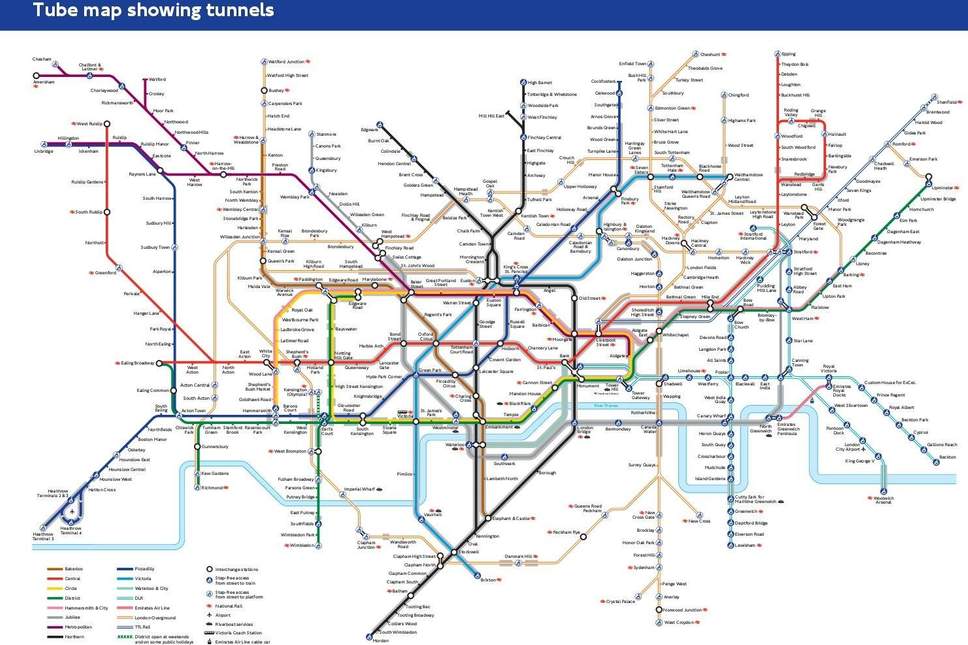
TfL has drawn up a Tube map to help people with anxiety avoid the most claustrophobic underground stations

Transport for London (TfL) has unveiled a new Tube map today to show which stations and sections of its network are underground in an effort to help passengers with claustrophobia and anxiety.
It said the new map will help users navigate the network more comfortably by showing routes they can take to avoid areas with large stretches of tunnels.
There are 270 stations on the Tube, but more than half are above ground, according to TfL. Of the Tube lines, the Victoria Line and the Waterloo & City Line are the two that are wholly underground.
So 45 per cent of the underground is in tunnels, and if you're looking to avoid particularly deep stations, you'll want to steer clear of Hampstead on the Northern Line. It measures 58.5m at its deepest point, while the westbound Jubilee platform Waterloo is 26m below sea level.
On the map, a grey overlay features on the stations or sections of the track which are underground, and there are also indicators for which London Overground, DLR and TfL Rail services are in tunnels.
The Central Line is home to the most Tube stations with no surface buildings, with the likes of Bank, Bethnal Green, Chancery Lane, Gants Hill and Notting Hill Gate dotted along it.
Mark Evers, director of customer strategy for TfL, said: “Making the Tube network accessible for everyone is one of our top priorities. This new map is just one of the tools we have created in response to feedback from our customers on how we can make the transport network more accessible, making travelling easier and more comfortable for all our customers.”
The transport body created the map after hearing from customers who find it difficult to use the Tube due to anxiety or claustrophobia.