Phantom islands thought to exist for hundreds of years are being “undiscovered”

On a voyage from Manila to Mexico in 1528, the Spanish captain Alavaro de Saaverda reported stopping off at a pair of islands a few thousand kilometres north of Papua New Guinea in the Philippine Sea. He named the islands Los Buenos Jardines, and wrote in his diary about the friendly natives he’d met there. The cartographer Mercator added the islands to his map of the world later that century, but when American and Japanese navies set out to find the islands again in the early 1940s, they weren’t where the charts said they were supposed to be. In fact, they were nowhere to be found.
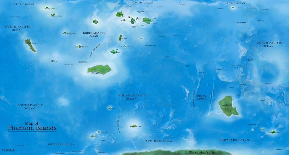
Los Buenos Jardines is one example of hundreds of “phantom islands,” non-existent places that were misreported, mostly during the age of discovery, either by mistake or wilfully. Empires would often pay their explorers for every new island they could discover and claim, and there were enough unscrupulous ship captains and demanding financiers that maps of the Caribbean and Pacific soon became littered with fictional isles that would stick around for centuries.
Others were borne out of myth. Hy-Brasil was believed to exist in the Atlantic Ocean west of Ireland, shrouded in a mist that lifted only once every seven years. Some were simply misidentifications of actual places, such as the long-held Spanish misconception that the Californian peninsula was an island.
“The phenomena of phantom islands points out the authority we grant to documents such as maps and atlases,” says Andrew Pekler, an artist and musican who documents these islands in his interactive audio map, the Sonic Atlas. “Once an island is entered on a map, it becomes ‘real’. Or at least as real as any other feature on the map.”

Even in the age of satellite photography, maps aren’t immune to these kinds of errors. Until as recently as 2012, Google Maps included Sandy Island, a phantom island “discovered” by Captain James Cook off the coast of Australia in 1774 (now believed to have been a pumice raft ejected from a volcanic eruption). It appeared as an ominous blob of black pixels in the satellite imagery, where Google’s algorithms had tried to reconcile the conflicting map data.
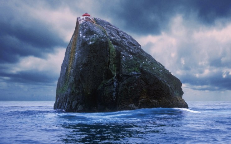
The debate over whether or not islands truly exist extends beyond cartographical trivia and into the realm of geopolitics. A nearby example, Rockall is an uninhabited chunk of granite barely jutting out of the Atlantic Ocean about 300km west of the Outer Hebrides, and over which the UK claims sovereignty. Whether or not the guano-spattered boulder met the legal definition of an island, which would have granted the UK full territorial and fishing rights for the surrounding waters, was a matter of debate until the mid-90s.
China has found a more direct solution to establishing territorial rights, dumping vast quantities of sand into the South China Sea to create around half a dozen new islands on top of existing reefs, an audacious act of terraforming that has strained geopolitical tensions in the region to breaking point. In an age of information, it no longer suffices to simply sketch a fake island on the map.
“We are amused by the inexactness of previous eras’ maps,” says Pekler, “but we should keep in mind that a map is always a particular perspective on the world.”
To find out more about phantom islands visit the Dark Matter exhibition at the Science Gallery. Follow Andrew Pekler at soundcloud.com/pekler