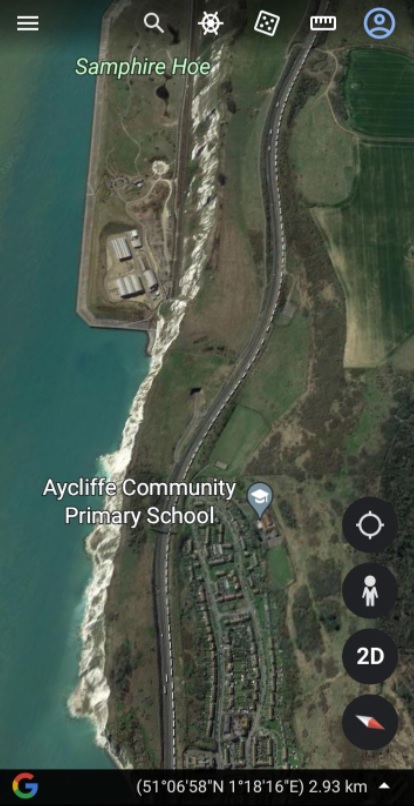
Brexit from the moon: Dover lorry queue can now be seen on Google Earth

As hundreds of lorries continue to queue before they can board a ferry in Dover, it has emerged that the unprecedented queue can now be seen on Google Earth.
Earlier this month, a 25-mile coastbound stretch of the M20 was closed to store thousands of lorries heading for the Port of Dover or Eurotunnel as part of so-called Operation Brock.
The queue is causing chaos on surrounding local roads with traffic on major routes in Kent having been brought to a standstill again due to delays in Channel crossings.
The A20 Roundhill Tunnel was closed under the Dover TAP scheme to prevent HGVs jumping the queue.
Delays to Channel crossings are being driven by the suspension of P&O Ferries sailings after the operator sacked nearly 800 seafarers without notice last month.